Technical Note on the Manaus' Study
The city of Manaus is located in the Amazon River watershed. It is the Brazilian municipality with the largest forest cover, accounting about 82.82% of its total population, with an estimated population of 2,219,580 (IBGE/2020), considered the third city that contributes the most to CO2 emission by inhabitants in Brazil.
Apparently, the comprehension that manauara population produces CO2 to be captured by the forest which, consequently, will be used for the oxygen production, would be potentially satisfactory if were not for the fact that the Amazon biome consumes most of the oxygen generated by it, leaving an insufficient amount for the atmosphere. This investigation is one of the nuances presented in the third paper released by the Urban Legal Amazon project that highlights how the Manaus’ population living and health conditions are affected by contexts caused by climate change.
In the study “Urban Inequalities and the Regional Metropolis in Times of Climate Change: A Socio-spatial Analysis of Manaus (AM)”, the research team uses a series of social, racial and economic indicators that corroborate on the assertion that the Amazonas’ state is far from ensuring the 2030 Sustainable Development Goals (SDGs) Agenda of the United Nations (UN), in terms of eradication poverty, building sustainable communities and cities in the 21st century.
The socio-spatial climate change analysis in the urban context of Manaus executed by the Urban Legal Amazon project identified the problem seriousness that the municipality needs to face and overcome, in order to formulate and implement public policies related to public and private interest to mitigate the impacts and also meet to the Brazilian State commitments assumed with international instruments for the protection of the environment, such as the United Nations Framework Convention on Climate Change (UNFCCC) and the 2030 SDGs Agenda of the UN.
In the chapter “Race/Ethnicity and Gender Inequalities and Climate Change in Manaus”, the study points, once again, to a direction that also was perceived in the municipalities of Belém and Macapá. Racism, poverty context, geographical and cultural conditions, and gender inequalities are determining vulnerabilities in the increase of climate change impacts in the city of Manaus.
However, such inequalities and the visibility of data disaggregated by gender and race, are not a point of attention of public institutions when it comes to deal with climate change impacts on the living and health conditions of the population, as example the elaboration of the Director Plan approved by the legislative.
This scenario is confronted by the research team based on a series of indicators analysis, including the Inequalities Map of the Brazilian capitals, published in 2020. For instance, in this map, the municipality of Manaus appears in the five worst indicators table, among the capitals of the country’s northern region, evaluated by the Sustainable Cities Program (n=12), considering the universe of 44 indicators proposed within the SDGs scope.
“According to the Census/IBGE data (2010), Manaus presents itself with a population composed for more women than men, and it is mostly black, with 72,16% identified as black and brown. Concerning socio demographic characteristics, most residents report no income or an income below the minimum wage, emphasizing on the expressive number of residents without decelerated income (43,39%). It expresses a high percentage of individuals without education or with incomplete elementary school (41.07%) and most of the population lives in urban areas.”
Therefore, the study includes that the Director Plan approved by the legislative does not consider such inequalities that face differently diverse social groups. As the invisibility and information disaggregation on the population profile damage the public policy elaboration that aims to face climate change.
In the chapter “Territorial Planning, Regional Metropolis and the Impacts of Climate Change in Manaus”, the Urban Legal Amazon project focuses on the municipal urban context and how it intensifies the inequalities and life differences in Manaus population. The highlight goes to the investigation of the Urban and Environmental Development Plan (PDUA) of Manaus, approved four years after the publication of the IBGE/2010 Census.
The exploration reveals, for instance, the territorial and population density reality of the subnormal agglomerates are invisible in the PDUA policy, which has as its main strategy the valorization of the municipality as a “Regional Metropole”.
“(…) The territorial planning of Manaus will be observed by two dimensions of climate change impacts and effects in urban areas: First – impact on urban areas: increasing risk of floods, increasing risk of landslides, migrations from rural areas, disruption of food supply networks; Second – impact on urban areas: more frequent flooding, greater risk of landslides, homes, factories and urban infrastructure damage.”
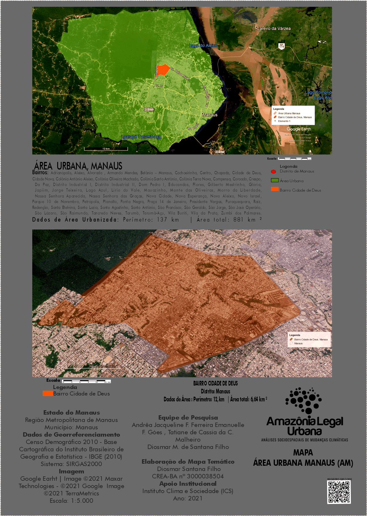
CLICK TO DOWNLOAD THE THEMED MAP OF THE URBAN AREA – MANAUS (AM)

The Manaus’s paper is available to download on the page “Publications”.
Juliana Dias
Communication Coordination
Urban Legal Amazon Project – Socio-spatial Analysis of Climate Change

